Year 12 Geography Trip to Snowdonia
On Thursday 14 May, the Year 12 Geography group set off on their biggest journey yet to Snowdonia, Wales, aiming to explore how glaciers have shaped the natural environment of the region. We started the day under sunny skies and high hopes in Bourne. However, the moment we stepped off the coach, Wales greeted us with fierce winds and pouring rain, quickly revealing who had come unprepared.
We hiked 4 kilometres along the Miner’s Track from the Pen-y-Pass car park, climbing approximately 160 metres in elevation. Along the route, we encountered a range of glacial landforms, including corries, tarns, roche moutonnées and many more, demonstrating both the erosional and depositional power of glaciers.
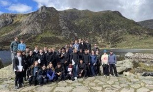
The second day began with a short coach ride followed by a hike to the source of the Nant Ffrancon Valley: Cwm Idwal, an iconic corrie surrounded by impressive glacial features, particularly its steep back wall and pronounced rock lip. During our fieldwork, we used OS maps to identify and analyse these features within the landscape. One of the most unexpected moments of the trip came during our group photo, when two fighter jets suddenly flew through the valley at low altitude, likely carrying out military training exercises due to the valley’s suitable topography.
Once back on the coach after our walk through Snowdon, we headed for the youth hostel in Llanberis, though not before tackling one final steep uphill walk carrying our bags. After an eventful dinner, a select few later continued on to a nearby waterfall, where we were rewarded with stunning scenery and even witnessed people rappelling down the waterfall itself. Many ended the evening playing UNO and chess in the youth hostel’s lounge before heading back to their rooms, preparing for an early start the next day.
After this memorable encounter, we travelled further down the Nant Ffrancon Valley to carry out a range of fieldwork investigations. This included mapping striations on top of a roche moutonnée to determine the direction of glacial movement that once dominated the valley. We also used ranging poles and clinometers to create a slope profile by measuring gradients at 2 metre intervals. Additionally, we investigated sediment sizes along the bank of a misfit stream using quadrats, helping us understand how modern rivers continue to erode and sort pre-existing glacial deposits over time.
As the trip came to an end, we took in the scenery one last time from the coach as we reluctantly left Snowdonia behind. Overall, the visit provided an unforgettable opportunity to experience glaciated landscapes firsthand while applying the geographical skills and knowledge learned in the classroom.
We would like to thank the Geography teachers and staff who made this trip possible.